


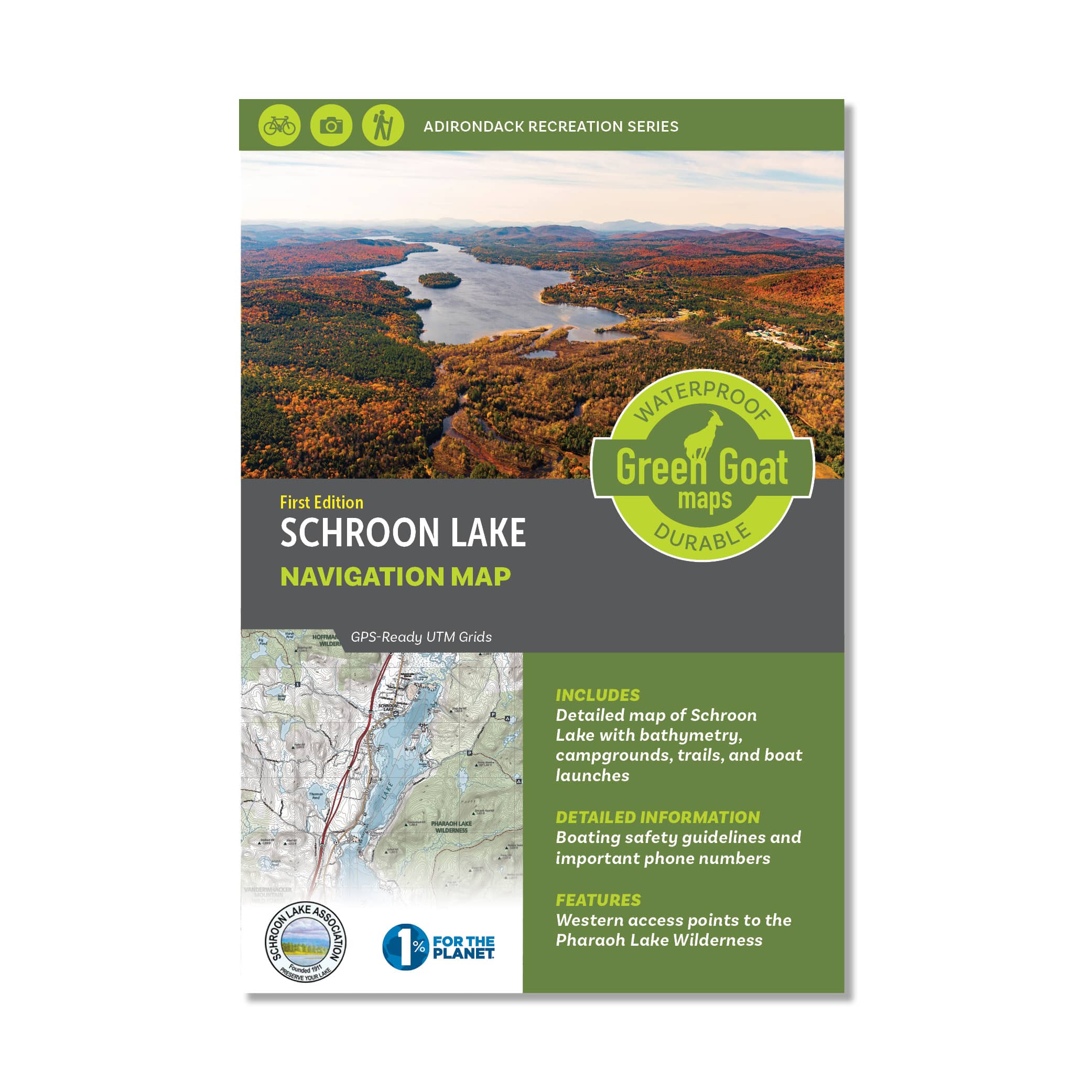
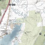

Schroon Lake Navigation Map
$12.95
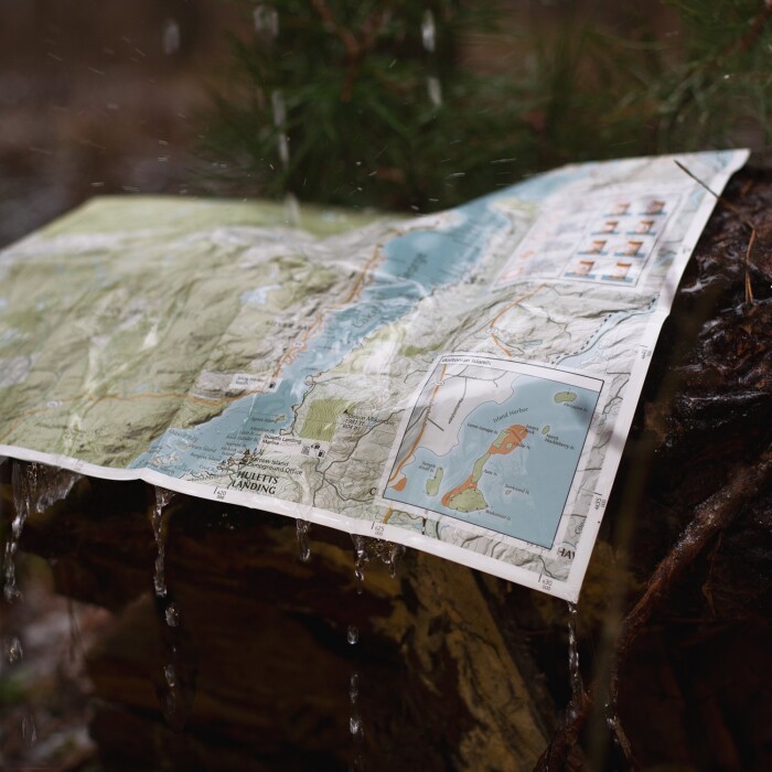
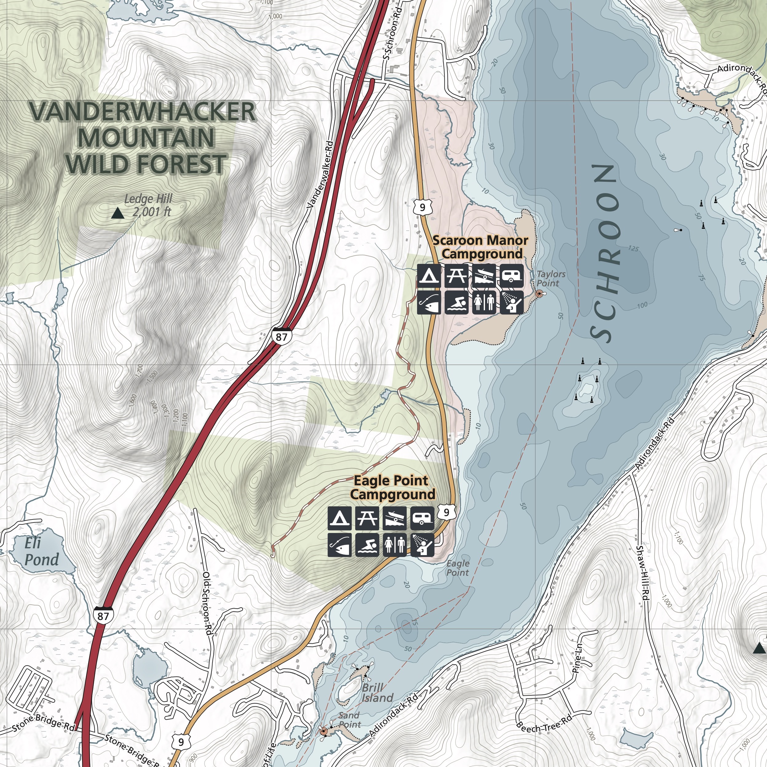
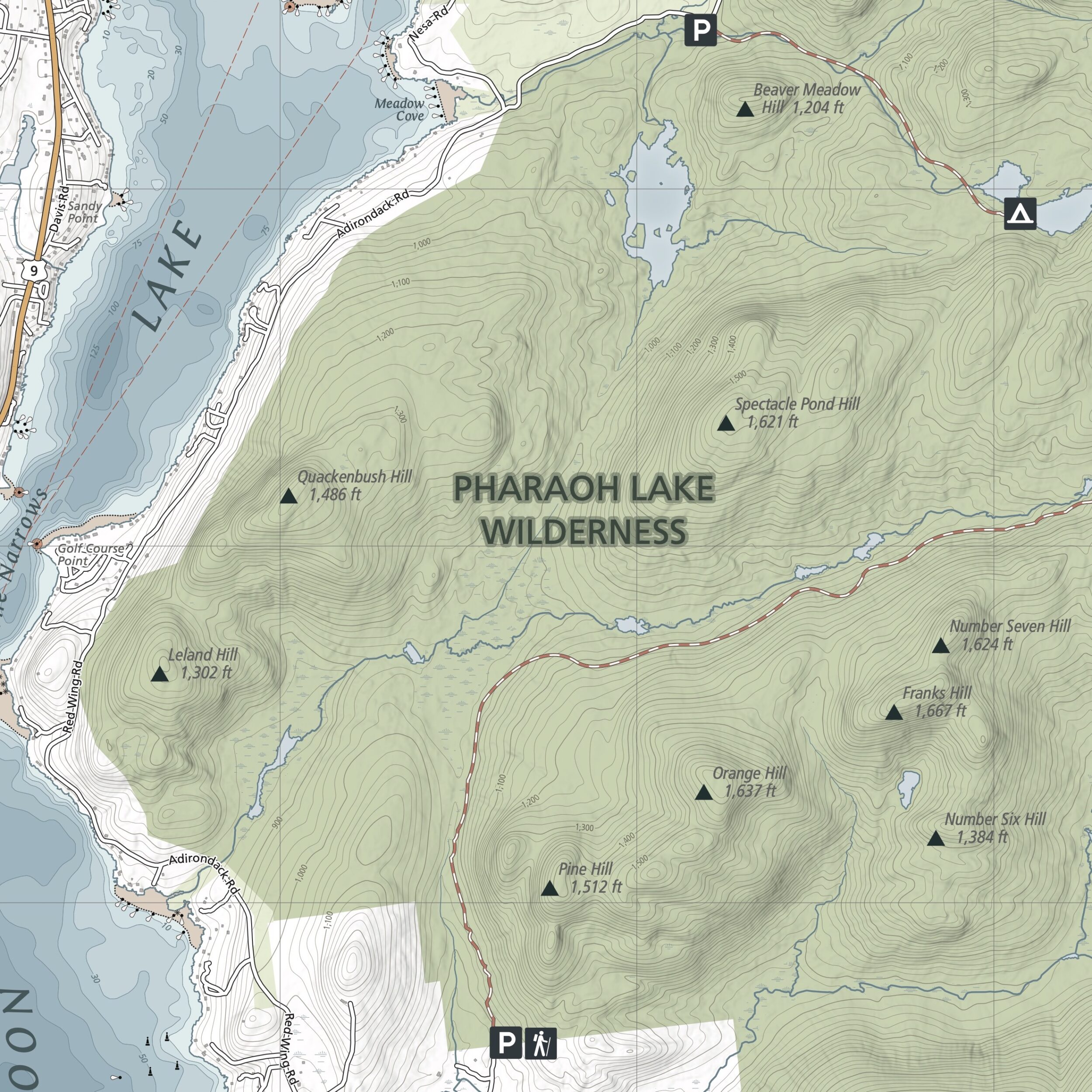
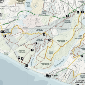
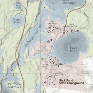
The Schroon Lake Navigation Map is created for locals and visitors alike! This map highlights campgrounds, trails, and boat launches around Schroon Lake in great detail. With complete bathymetric information, boating safety guidelines, and important phone numbers, you can have peace of mind while enjoying your next boating adventure. Partnered with The Schroon Lake Association in the creation of this map, we strive to help educate the public about this beautiful lake and how we can best take care of it!
IMPORTANT: Are you a member of the Schroon Lake Association? As part of our partnership with them, they plan to send out free maps to members at the Family ($45) level and above free of charge as part of your membership.
- Map Highlights
- 100% satisfaction return policy
- Description
- Reviews (0)
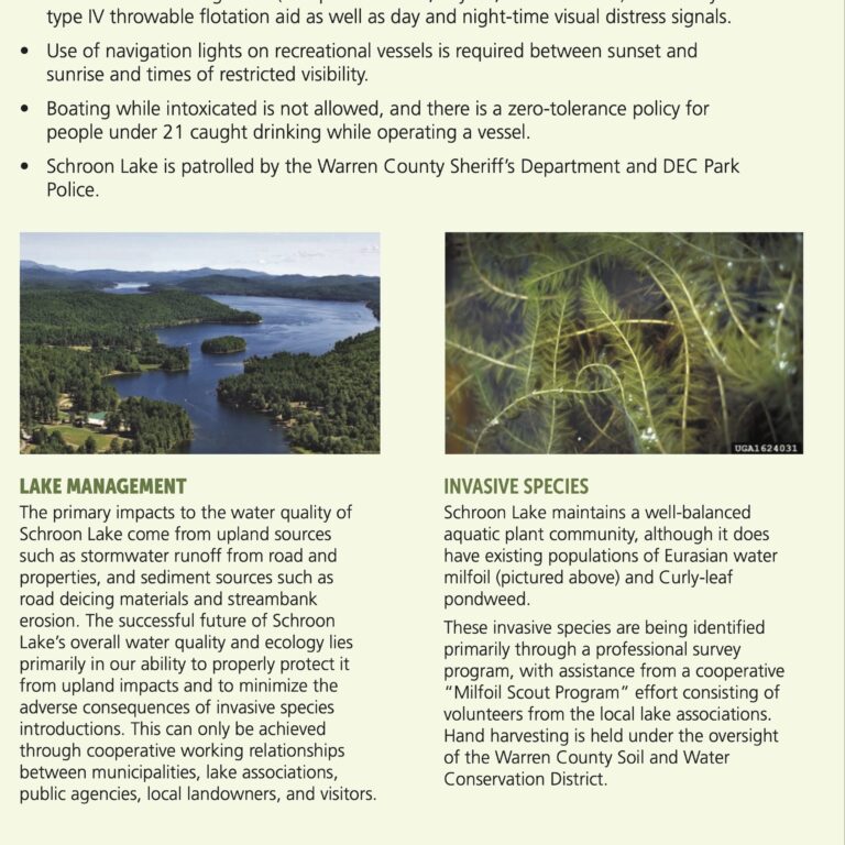
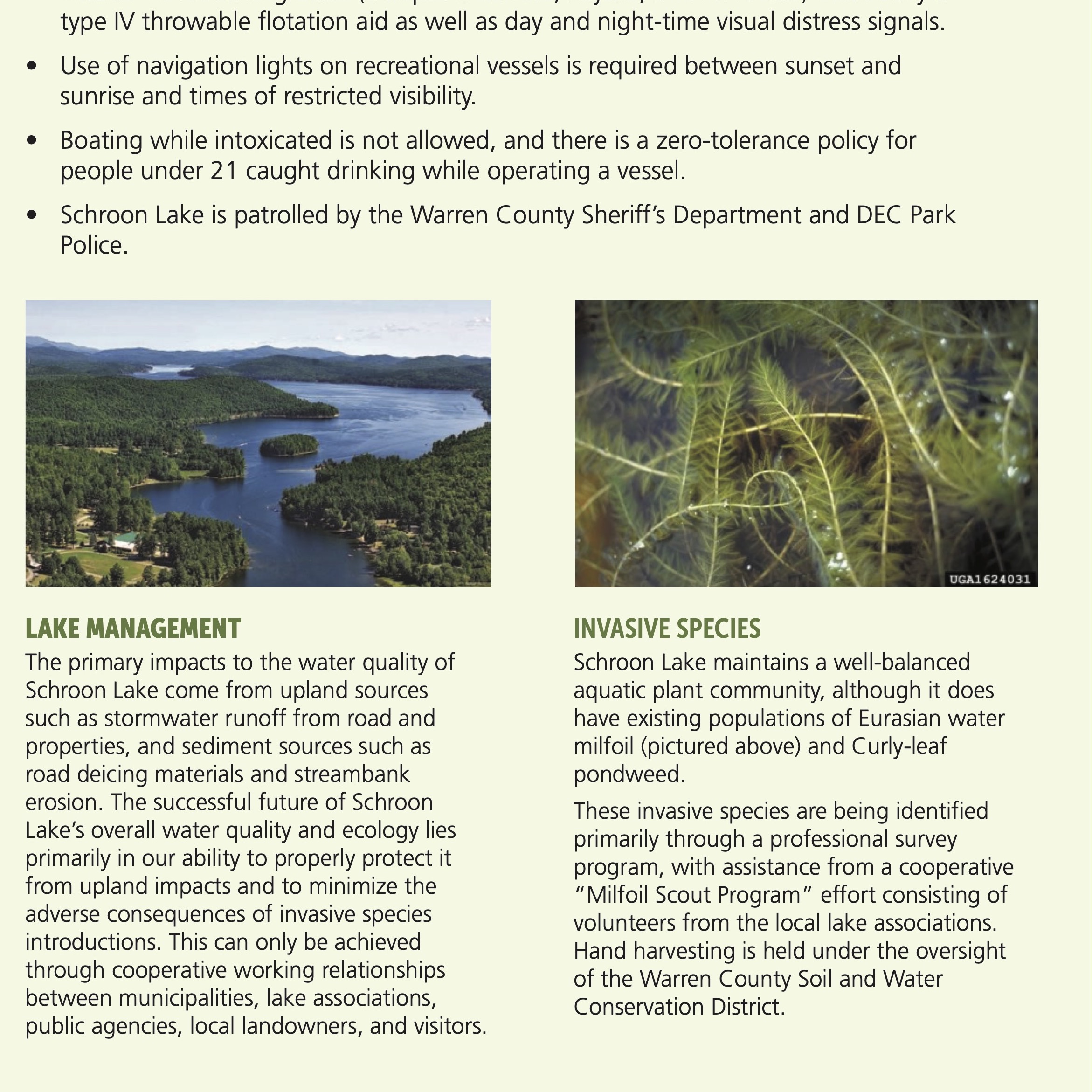
- Information about fishing on Schroon Lake, invasive species, and lake management
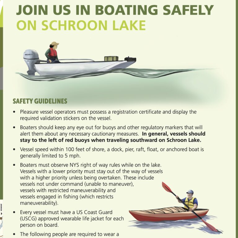
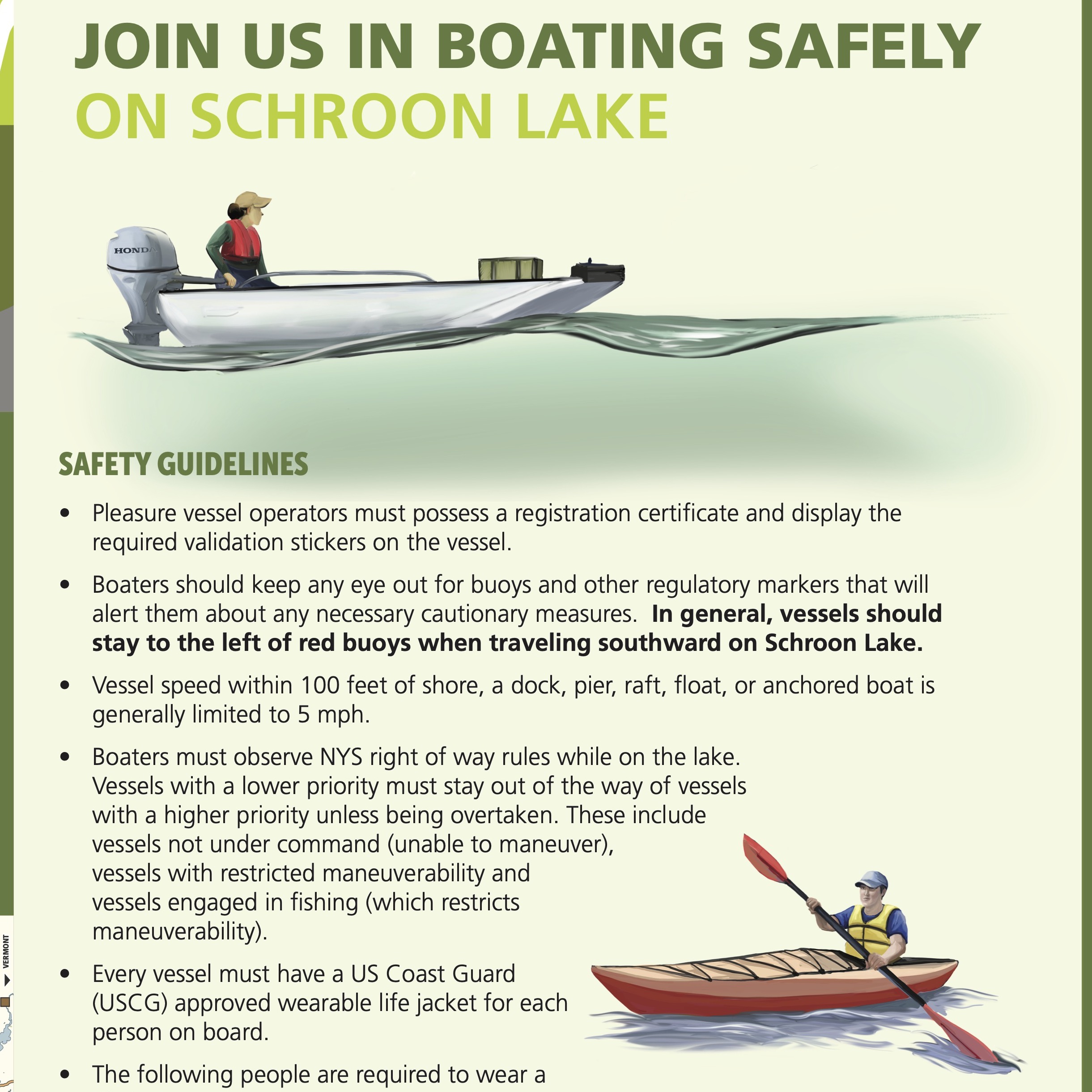
- Safety guidelines and important phone numbers
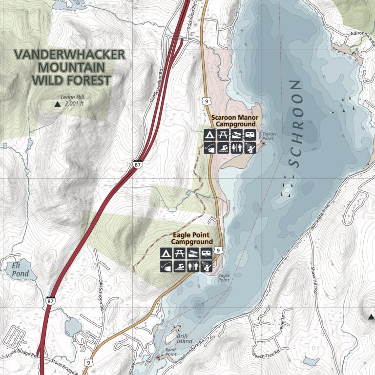
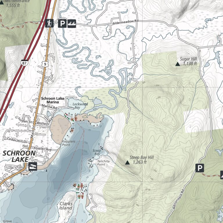
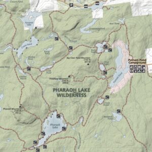
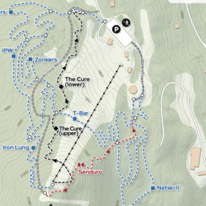
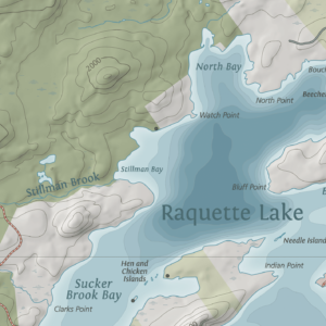
- Campgrounds, bathymetry, trails, boat launches, western access points to the Pharaoh Lake Wilderness
- Printed on durable, high-quality waterproof material
We know you’ve got a lot going on, whether you’re planning a trip or gathering equipment for your Saturday family adventure. Don’t worry – we’ve got you covered. If this map isn’t perfect for your adventure, just let us know and we’ll refund your payment or send you a different map. We want you to be successful out there! Take a moment to view our shipping and returns policy.
Description
Printed on waterproof HopSyn material. Durable and tear-resistant. Made in the USA:
Cartography done in New York, printing done in Colorado. Map measures 16×24” unfolded, 4×6” folded
Green Goat mappers are researchers at heart! Check out our partner company Adirondack Research to see all of the other environmental research and GIS mapping projects we are working on.

Reviews
There are no reviews yet.