GIS Mapping
Adirondack Research makes maps and performs geospatial analyses related to the environment, ecological species distributions and for land acquisition and conservation easements. We also produce a line of recreation and way-finding maps under the brand Green Goat Maps. We pride ourselves on high-quality work and fast turnaround time. Please consider us for your regular GIS needs.
Recent Related Projects
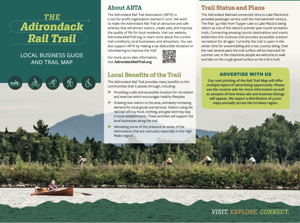
Adirondack Rail Trail Map and Brochure
ProcellaCOR Permit Aquatic Pant Survey on Lake George
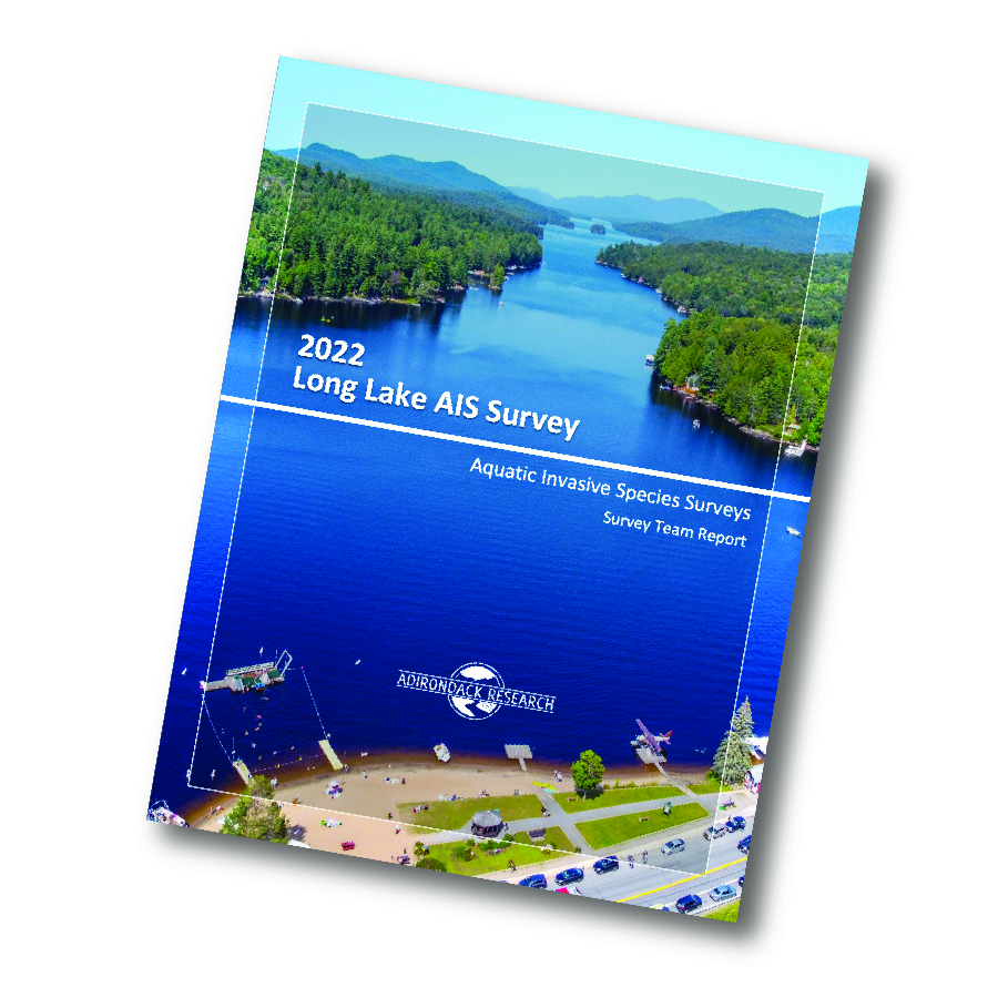
Follow-up AIS Survey for Long Lake
Early Detection Surveys for Lake Associations
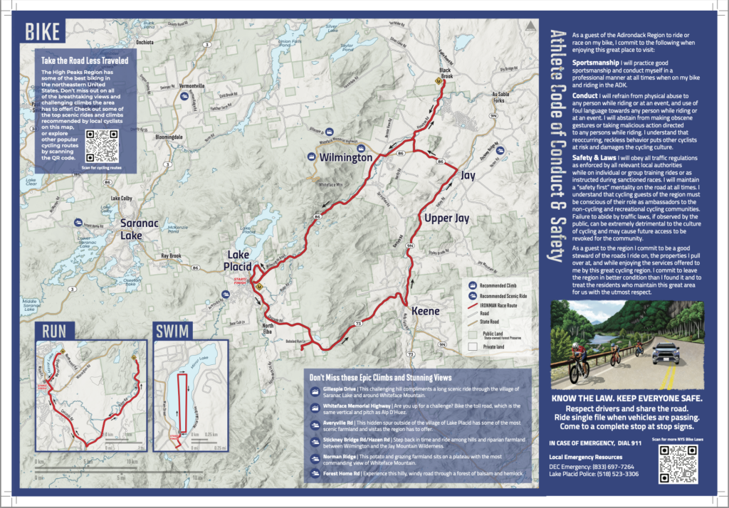
Ironman Athlete Map and Conduct Guide
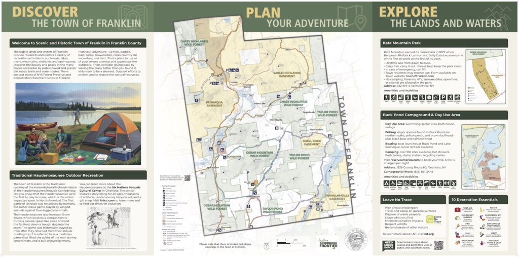
Town of Franklin Signage
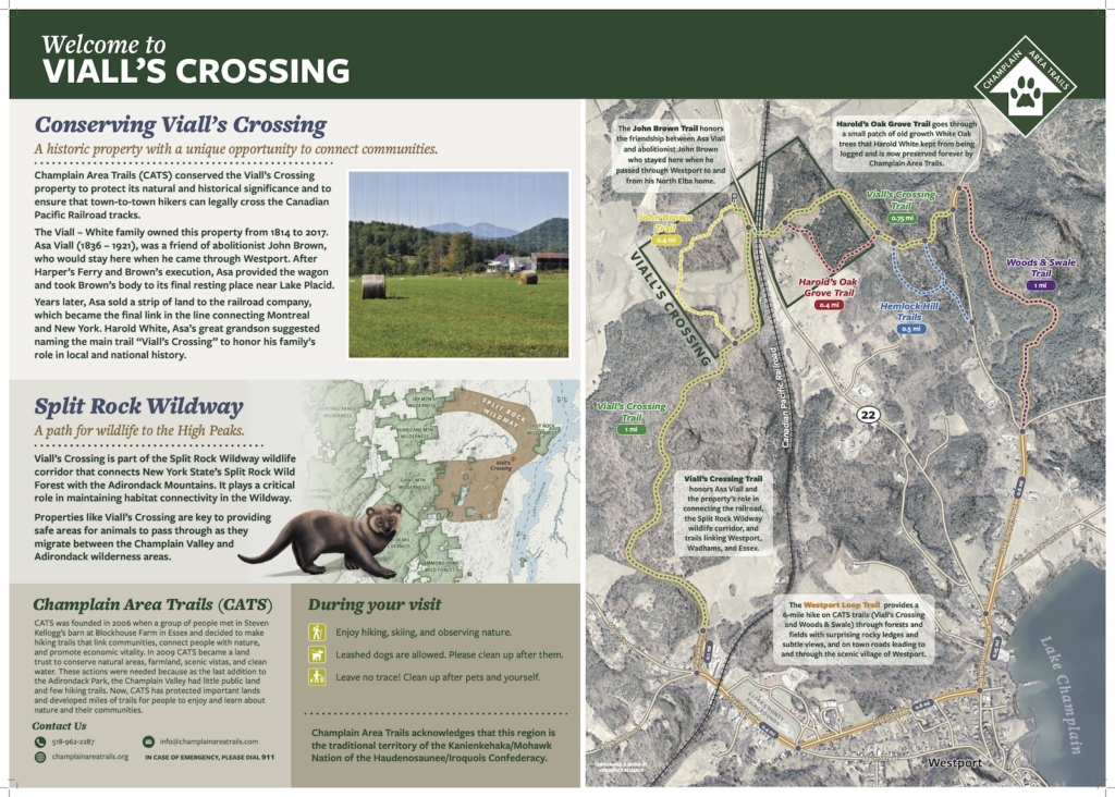
Viall’s Crossing Signage
Grant Application and Report Maps
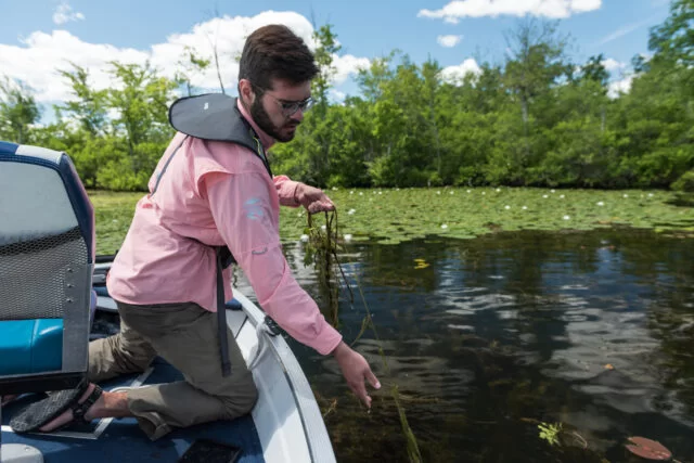
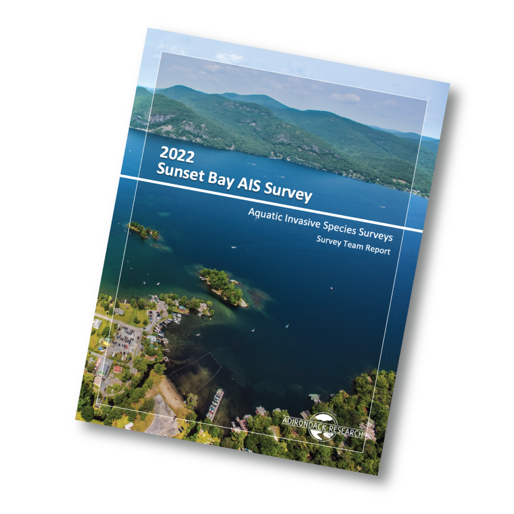
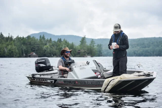
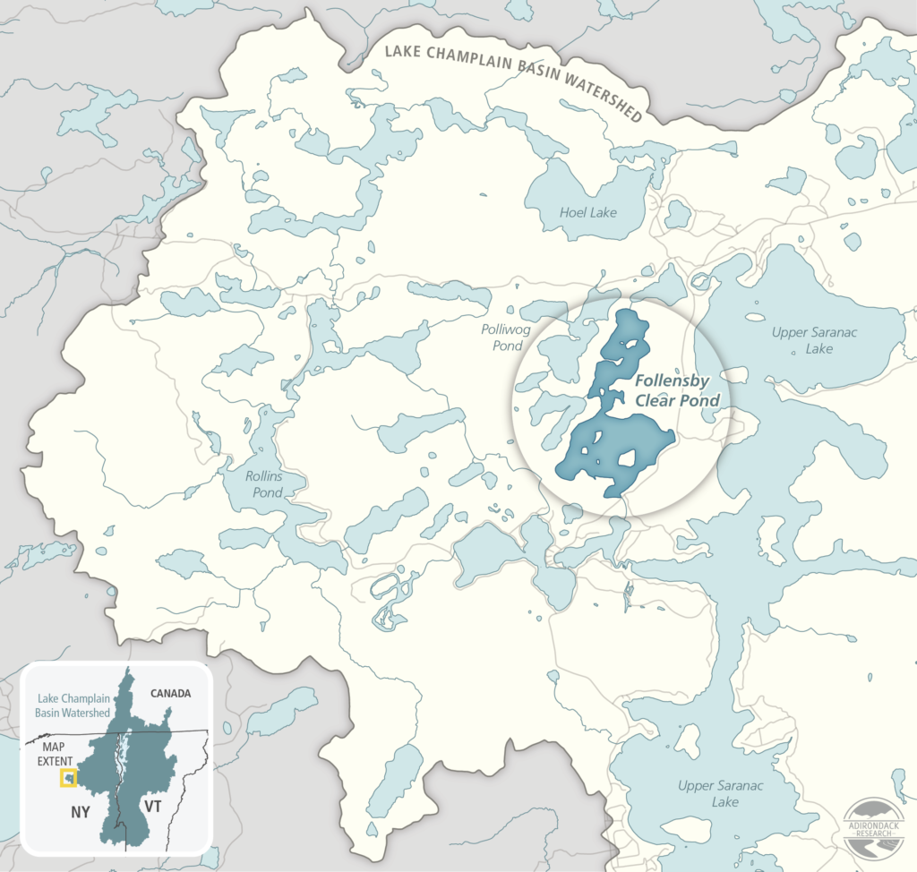
Surveying Adirondack Lakes for Invasive Species
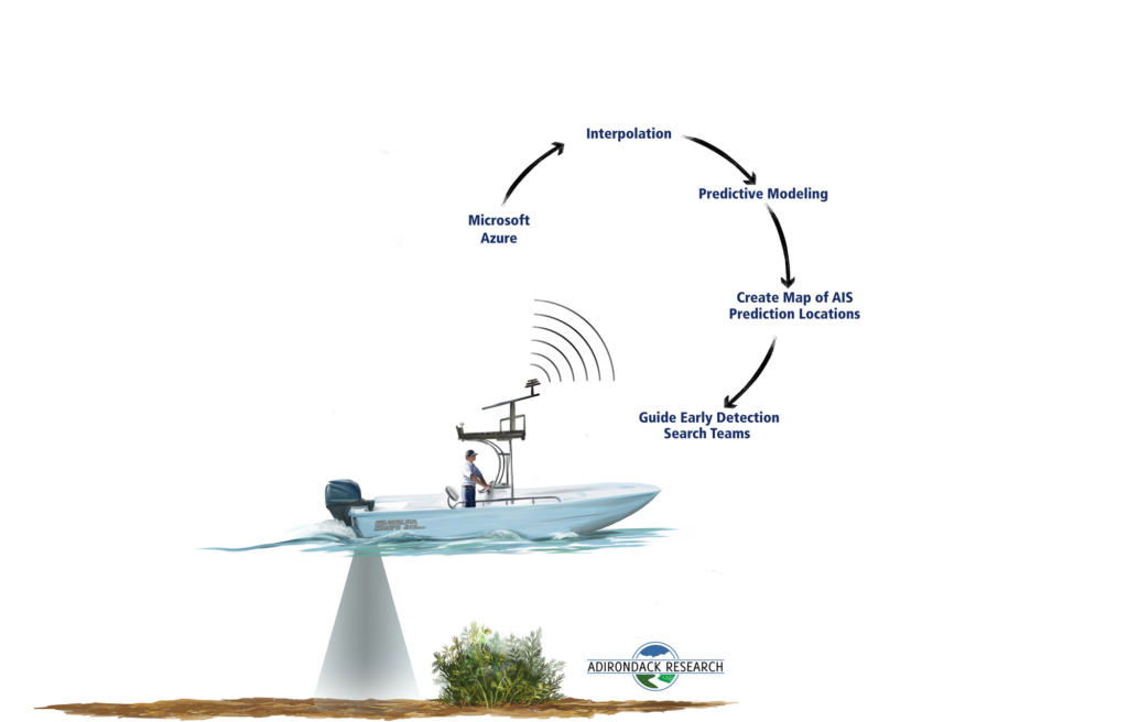
Aquatic Invasive Species Early Detection and Rapid Response with Microsoft
Adirondack Research’s services include:
- Site and infrastructurae planning
- Environmental mapping using geographic information systems (GIS)
- Community way-finding maps
- Biological inventories and private landowner maps
- Field experiment logistics
- Ecosystem services assessment
- Invasive pest management planning and analysis
- Education and advocacy materials