Cartography
We produce high-quality cartography products (maps) to support our research on invasive species, as outputs of our GIS contracts, and as beautiful maps and way-finding displays for clients. We have created way-finding displays for The Nature Conservancy, Barkeater Trails Alliance, Champlain Area Trails, as well as for municipalities. We take pride in the cartographic maps we are able to create for our clients.
Recent Related Projects
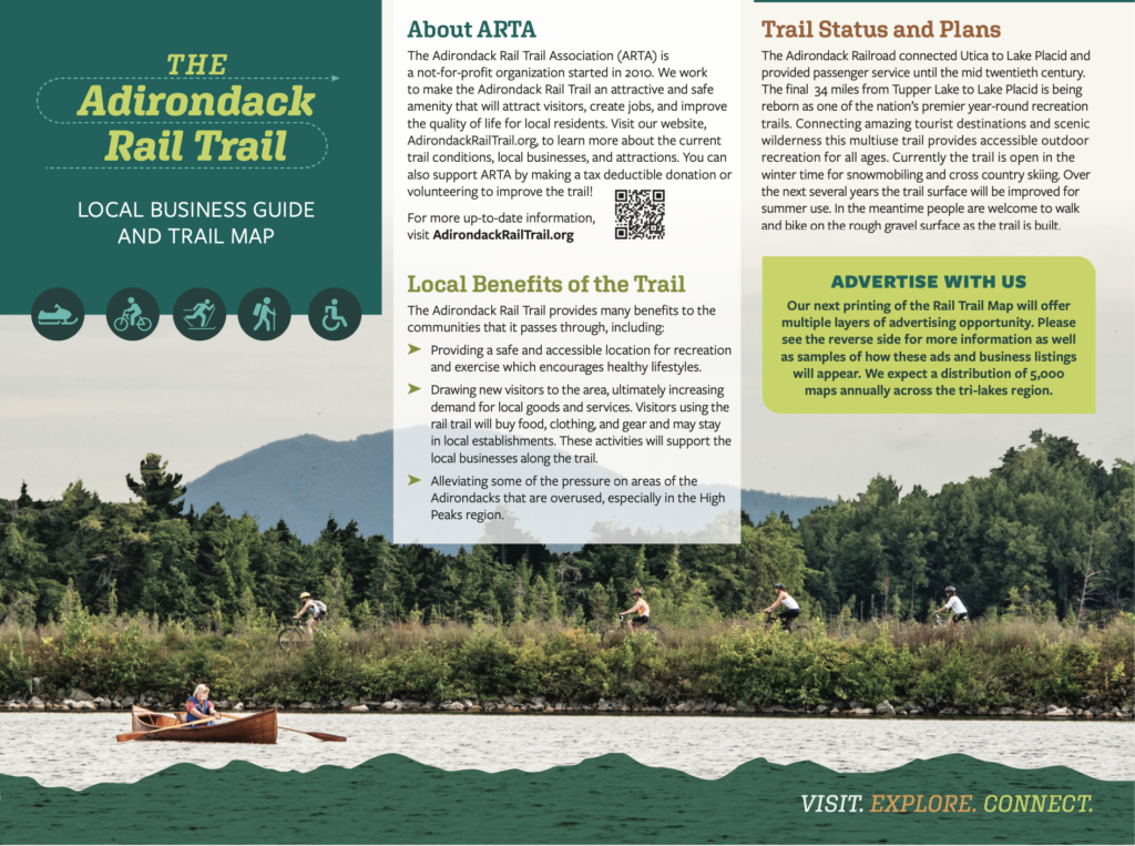
Adirondack Rail Trail Map and Brochure
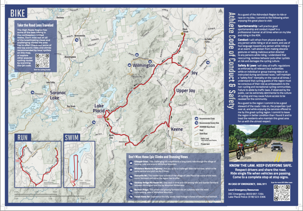
Ironman Athlete Map and Conduct Guide
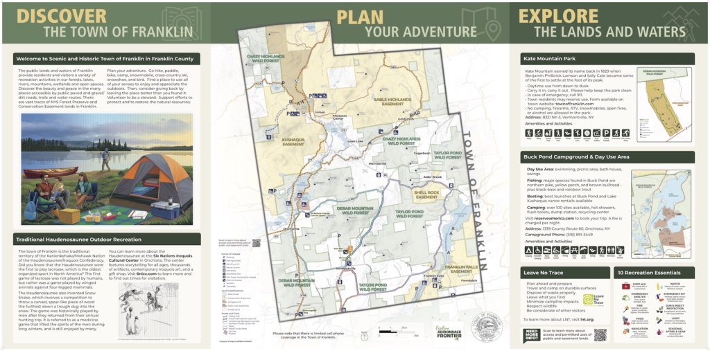
Town of Franklin Signage
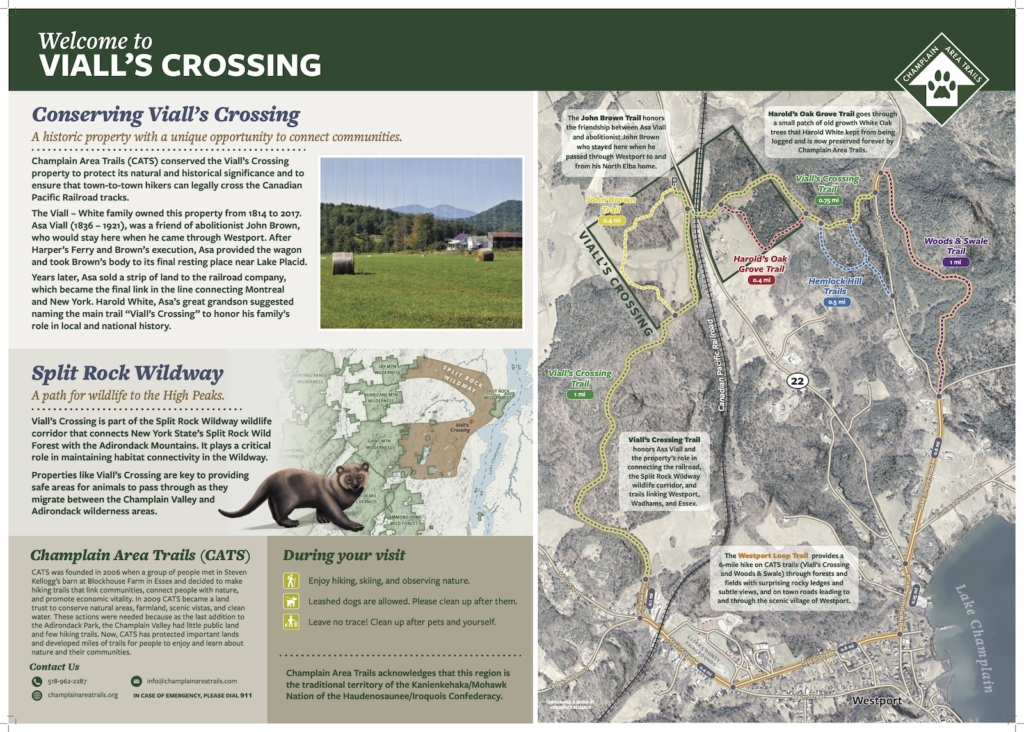
Viall’s Crossing Signage
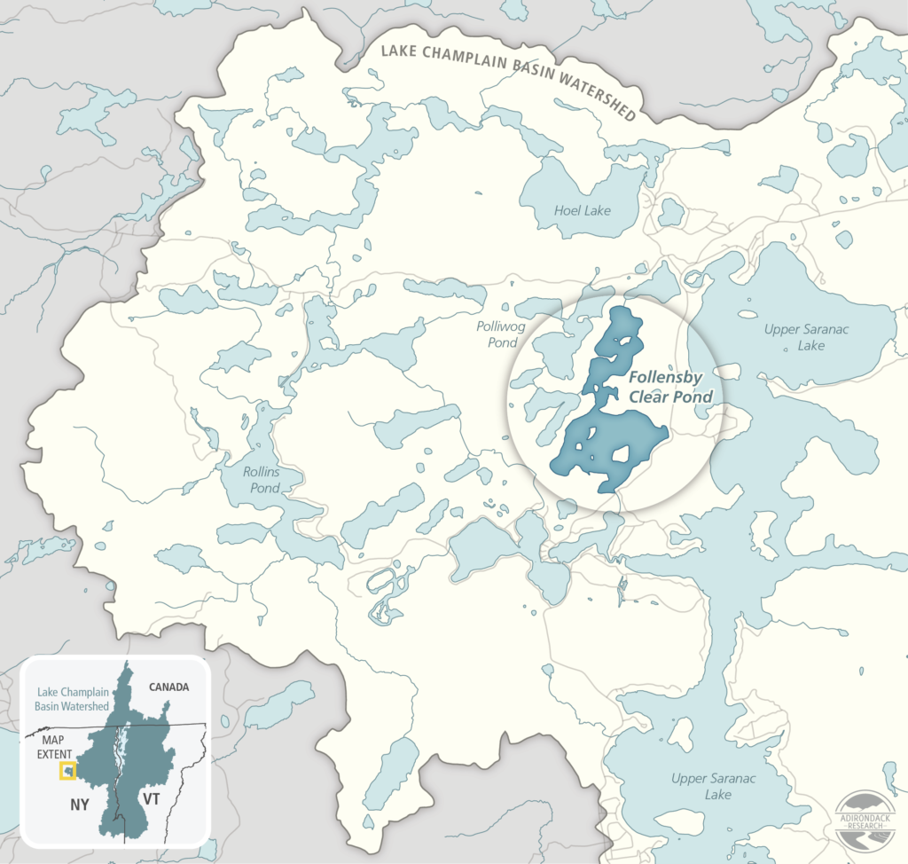
Grant Application and Report Maps
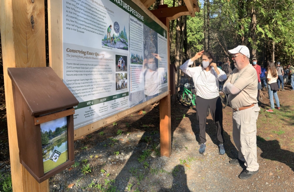
Essex Quarry Nature Preserve Signage
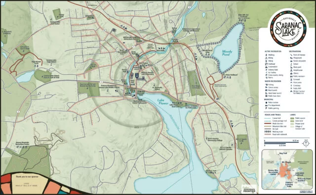
Wayfinding Maps for Saranac Lake
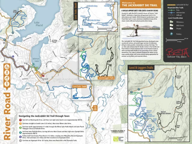
Trailhead Kiosks on Jackrabbit Ski Trail
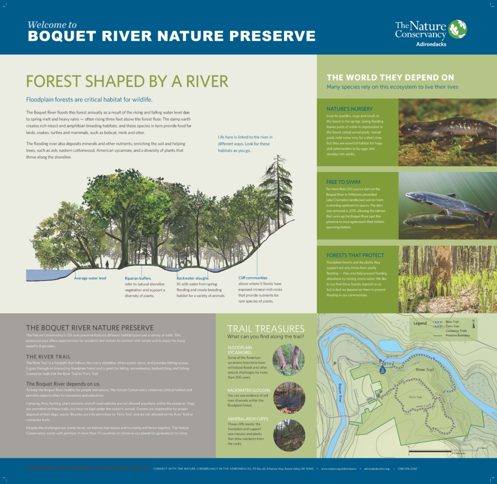
Boquet River Interpretive Signage
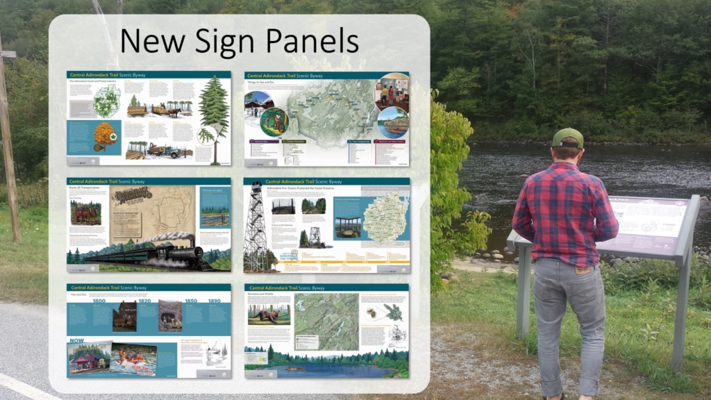
Interpreting the Hudson River & Central Adirondack Trail Scenic
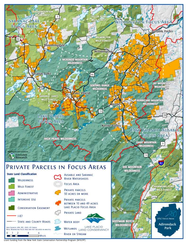
Engaging Residents in Land Conservation
Adirondack Research’s Cartography services include:
- Scientific illustrations and maps
- Professional graphic design and illustration
- Public outreach and stakeholder engagement
- Expert witness testimony and supporting maps
- Maps of private land holdings and nature preserves
- Trailhead kiosks (Example)
- Grant application maps and infographics