
Portfolio Description
- 0
- May 13, 2022
- Cartography
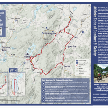
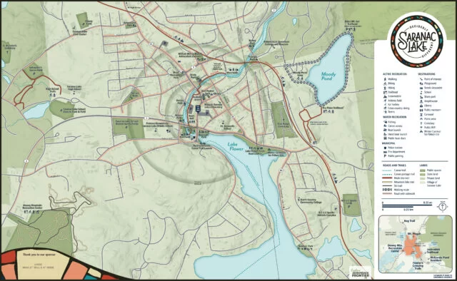
Adirondack Research was tasked with drafting a new map that would cater to residents and visitors and complement the DRI funding’s infrastructure enhancements. The map needed to provide clear wayfinding information, be aesthetically appealing, and support the principles and standards of the Village’s Complete Streets Policy.
The new maps were created from scratch using cartographic software that showcased the uniqueness of Downtown Saranac Lake. The map covered a similar geography as the previous map but included a legend, a small-scale map of the larger Saranac Lake region, and two large-scale inset maps of downtown Saranac Lake and Moody Pond. These maps were designed to fit the existing wayfinding kiosks and could be resized for websites or printed materials.
The new map design helped visitors and residents become familiar with the downtown area’s geography and navigate to points of interest, natural amenities, and services. The map was a useful and aesthetically pleasing resource for all users, supporting the Village’s Complete Streets Policy and promoting access, mobility, and health for everyone.
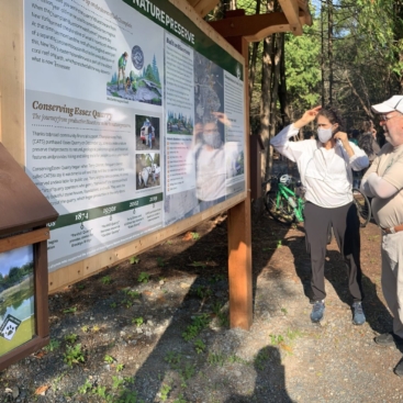
Client: Village of Saranac Lake Medium: Vinyl wrapped DiBond mounted on trail kiosk Size: Varied (48″x24″, 24″x36″, 24″x18″) Attribution: Nicole Keating was the cartographer and graphic designer, Carrie Griffo performed research, and Ezra Schwartzberg was the production coordinator.
Portfolio Details
-
Client:
Village of Saranac Lake
-
Members: