

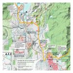

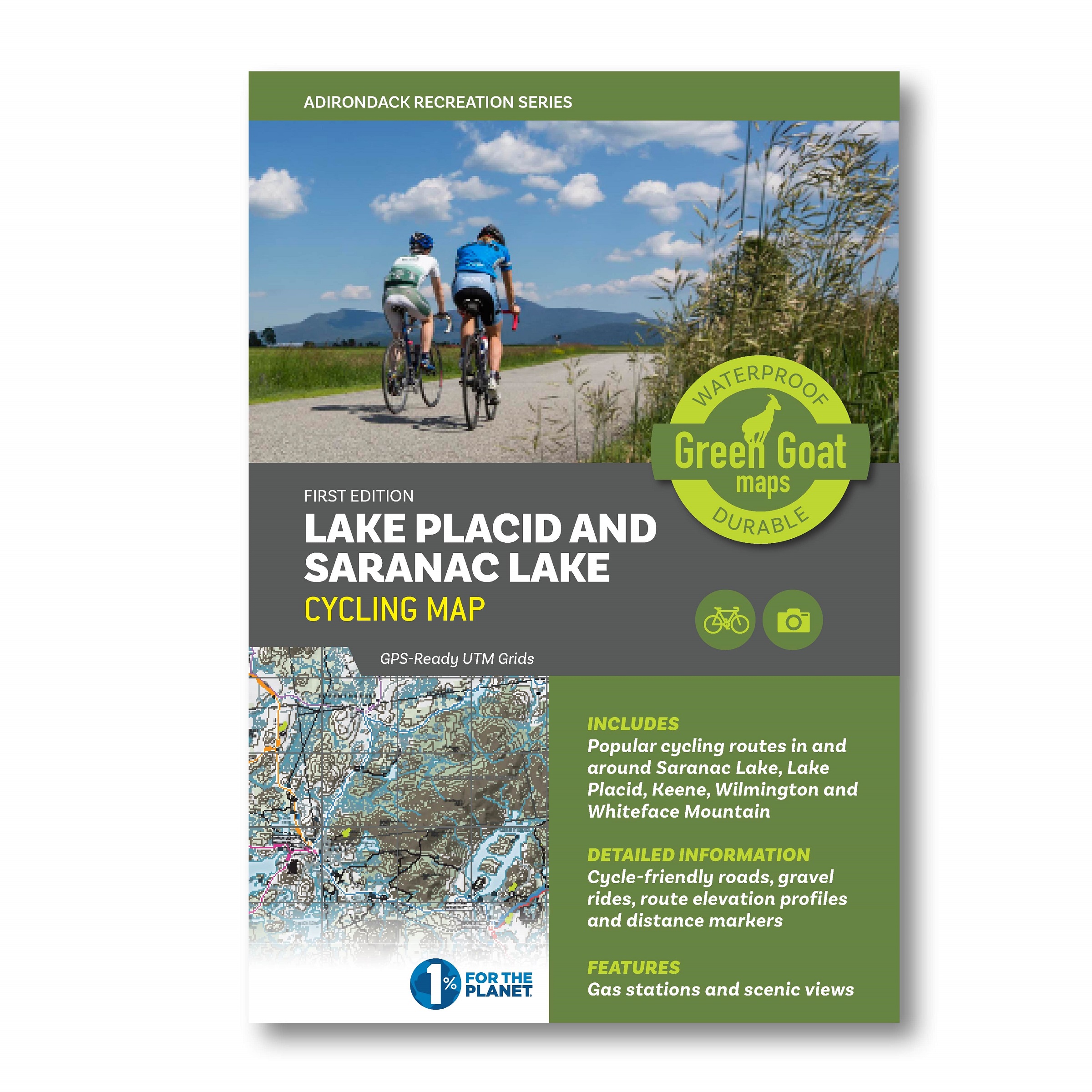
Lake Placid & Saranac Lake Winter Trails Map
$11.95
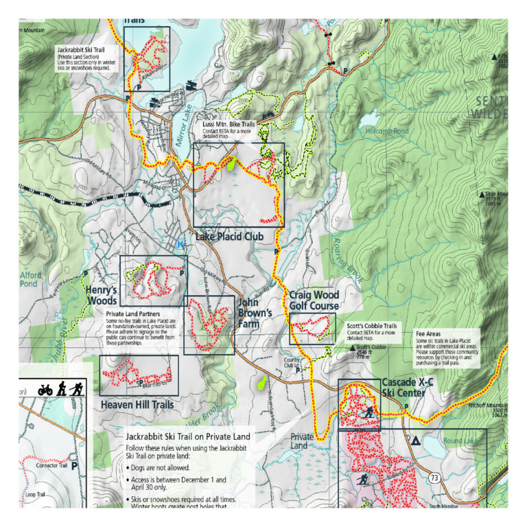
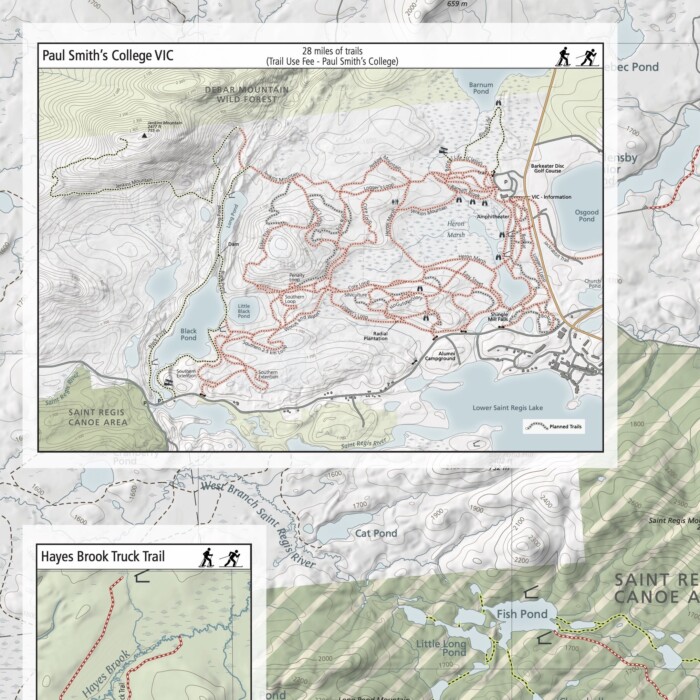
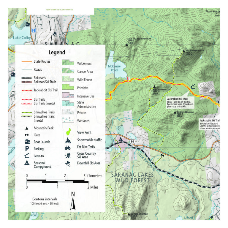
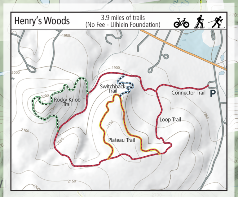
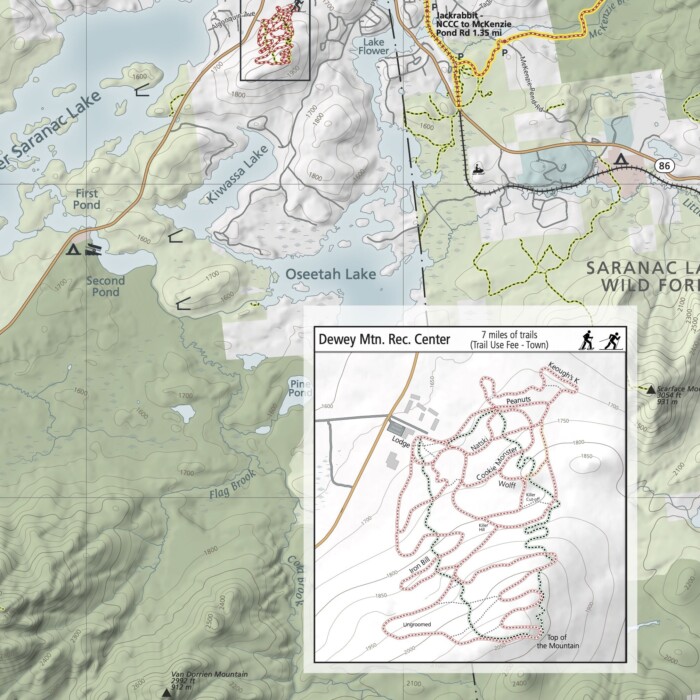
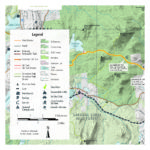
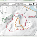
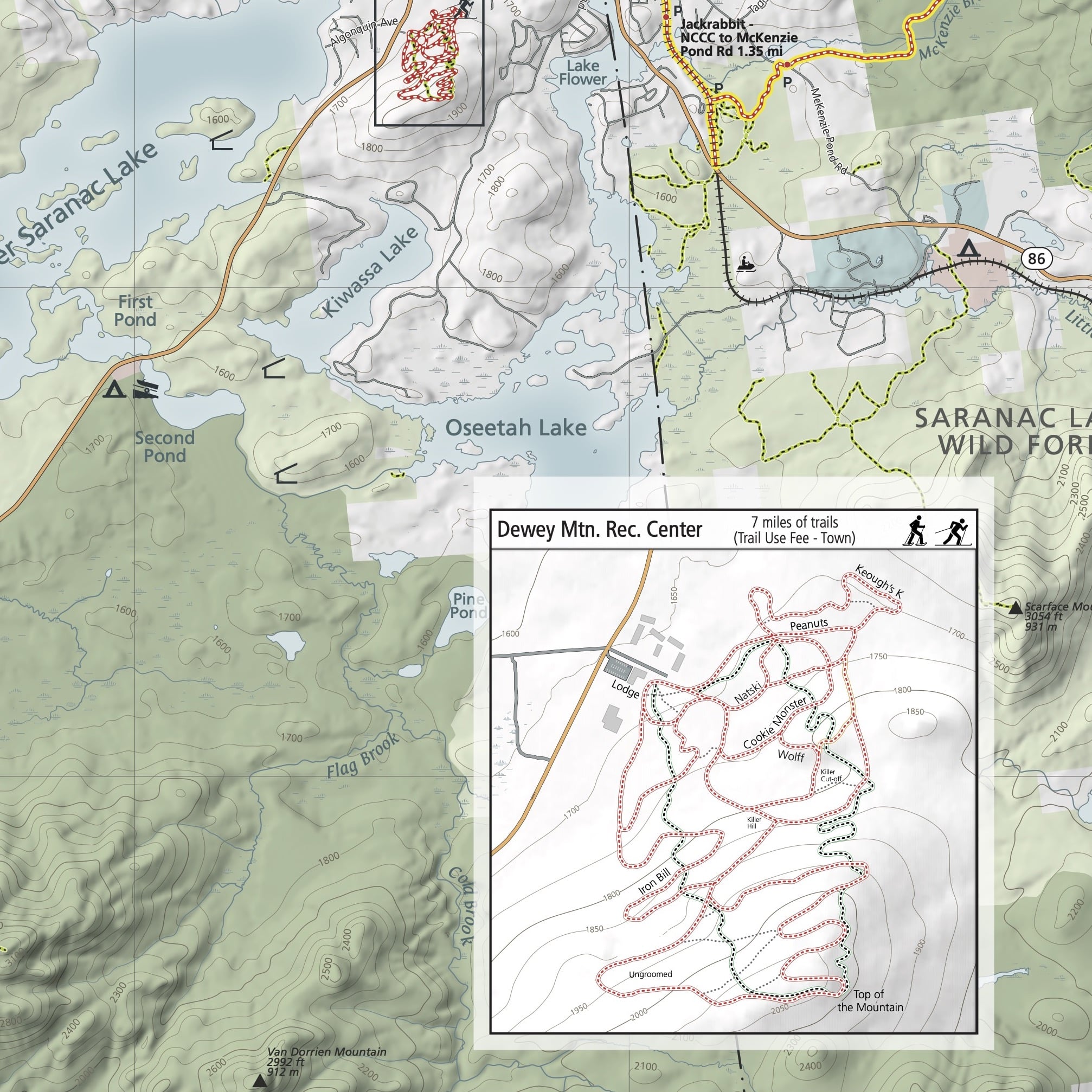
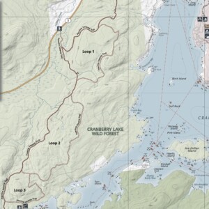
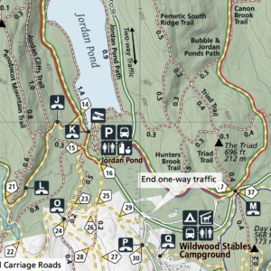
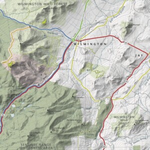
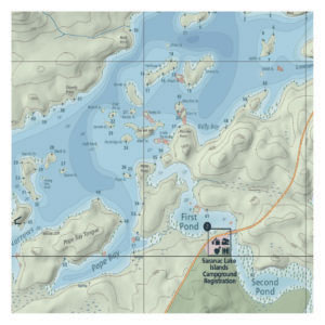
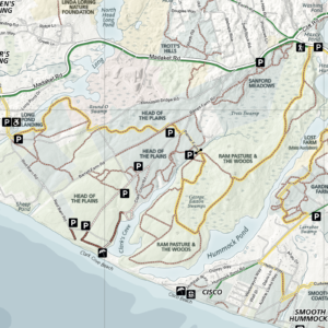
This is the region’s go-to map for winter recreation. The Lake Placid and Saranac Lake Winter Trails Map offers all of the area’s cross-country ski, snowshoe and fat bike trails in one convenient place. Our beautiful map highlights the beloved Jackrabbit Ski Trail and covers ski trails from Paul Smiths to Wilmington, including the popular Hayes Brook Truck Trail, Deer Pond Trails, Moose Pond Trail, Brewster Peninsula Trails, Henry’s Woods, Heaven Hill and more near the Adirondack High Peaks. We’ve also included the commercial ski centers, including the Paul Smith’s College VIC, Dewey Mountain Recreation Center, Cascade X-C Ski Center and Mt. Van Hoevenberg.
All of our maps have an ecological focus. This map, with a partnership through the Barkeater Trail Alliance, highlights responsible winter recreation. Green Goat Maps gives 1% back to nonprofits through 1% for the Planet.
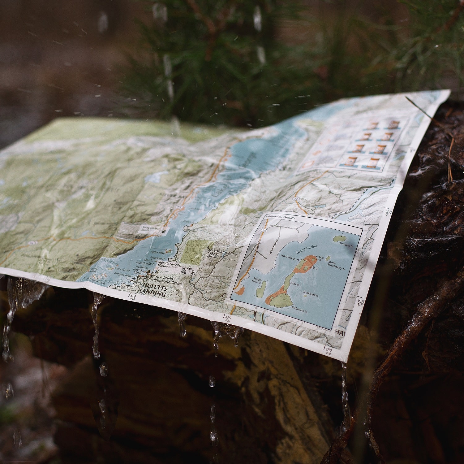
Made in the USA. Trail map measures 18×24″ unfolded, 4×6″ folded.
- Map Highlights
- 100% satisfaction return policy
- Description
- Additional information
- Reviews (0)
- Trail information for Lake Placid and Saranac Lake including the Jackrabbit Ski Trail, Paul Smith’s College VIC, Hayes Brook Trail, Deer Pond Trails, Moose Pond Trail, Brewster Peninsula Trails, Henry’s Woods, and Heaven Hill
- Ski centers including Paul Smith’s VIC, Dewey Mountain Recreation Center, Cascade X-C Ski Center and Mt. Van Hoevenberg
- Winter trail information for cross country skiing, snowshoeing, and fat tire biking
- Printed on durable, high-quality waterproof material
We know you’ve got a lot going on, whether you’re planning a trip or gathering equipment for your Saturday family adventure. Don’t worry – we’ve got you covered. If this map isn’t perfect for your adventure, just let us know and we’ll refund your payment or send you a different map. We want you to be successful out there! Take a moment to view our shipping and returns policy.
Description
Printed on waterproof HopSyn material. Durable and tear-resistant. Made in the USA:
Cartography done in New York, printing done in Colorado. Map measures 18×24” unfolded, 4×6” folded.
Green Goat mappers are researchers at heart! Check out our partner company Adirondack Research to see all of the other environmental research and GIS mapping projects we are working on.
*Second Edition
Additional information
| Weight | 1 oz |
|---|
Reviews
There are no reviews yet.