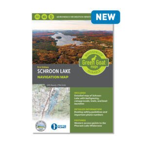


Ausable River Fly Fishing Map (Wholesale)
$7.17
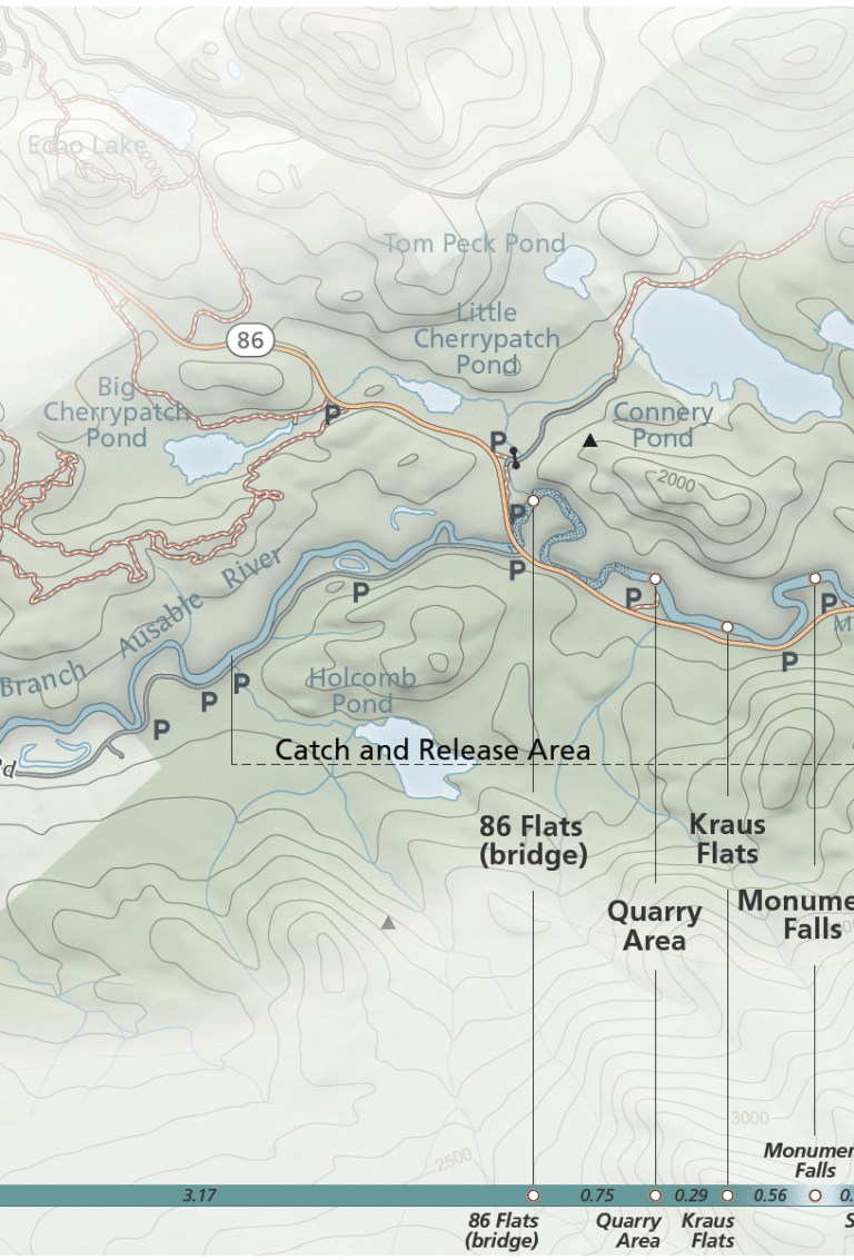
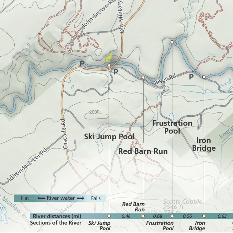
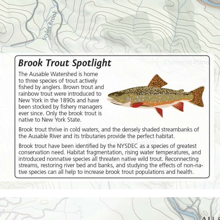
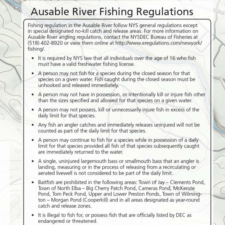
This Map features East Branch and West Branch Ausable River, river current, access paths, parking areas, NYS fishing regulations, and more. Made with river users of every kind in mind, this map is ideal for anglers, paddlers, and all who enjoy exploring and recreating on the beautiful Ausable River. As with all of our maps, this map has an environmental focus, and working with the Ausable River Association we were able to highlight the importance of river health and native brook trout.
All of our maps have an ecological focus. This map highlights invasive species prevention. Green Goat Maps gives 1% back to nonprofits through 1% for the Planet.
- Map Highlights
- 100% satisfaction return policy
- Description
- Additional information
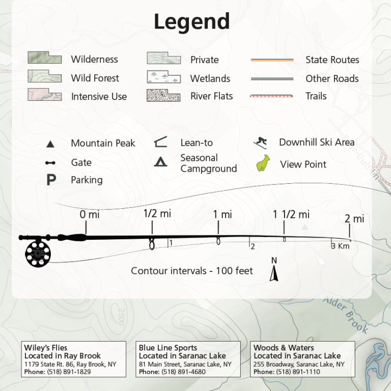
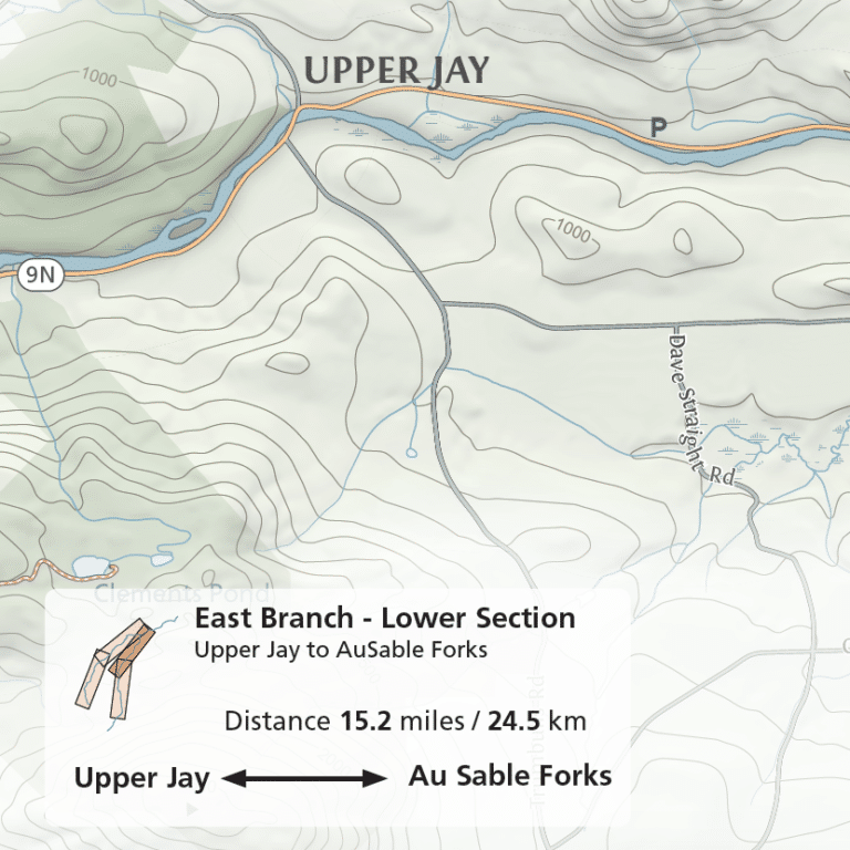
- Angling and hiking information for the East and West branches of the Ausable River
- Fishing pools, trail information, access points, parking areas, and local fly shops
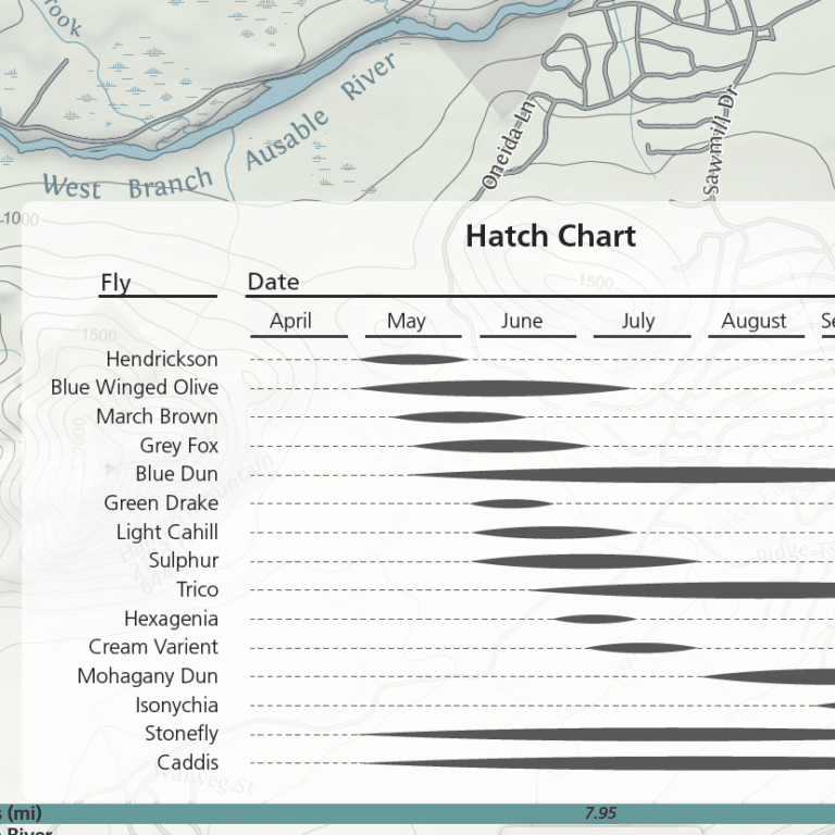
- River currents, labeled fishing pools, and a hatch chart
- Printed on durable, high-quality waterproof material
We know you’ve got a lot going on, whether you’re planning a trip or gathering equipment for your Saturday family adventure. Don’t worry – we’ve got you covered. If this map isn’t perfect for your adventure, just let us know and we’ll refund your payment or send you a different map. We want you to be successful out there! Take a moment to view our shipping and returns policy.
Description
Printed on waterproof HopSyn material. Durable and tear-resistant. Made in the USA:
Cartography done in New York, printing done in Colorado. Map measures 24×12” unfolded, 4×6” folded.
Green Goat mappers are researchers at heart! Check out our partner company Adirondack Research to see all of the other environmental research and GIS mapping projects we are working on.
Additional information
| Weight | 4 oz |
|---|