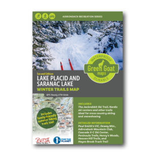


Saranac Lake Boating & Fishing Map (Wholesale)
$7.17
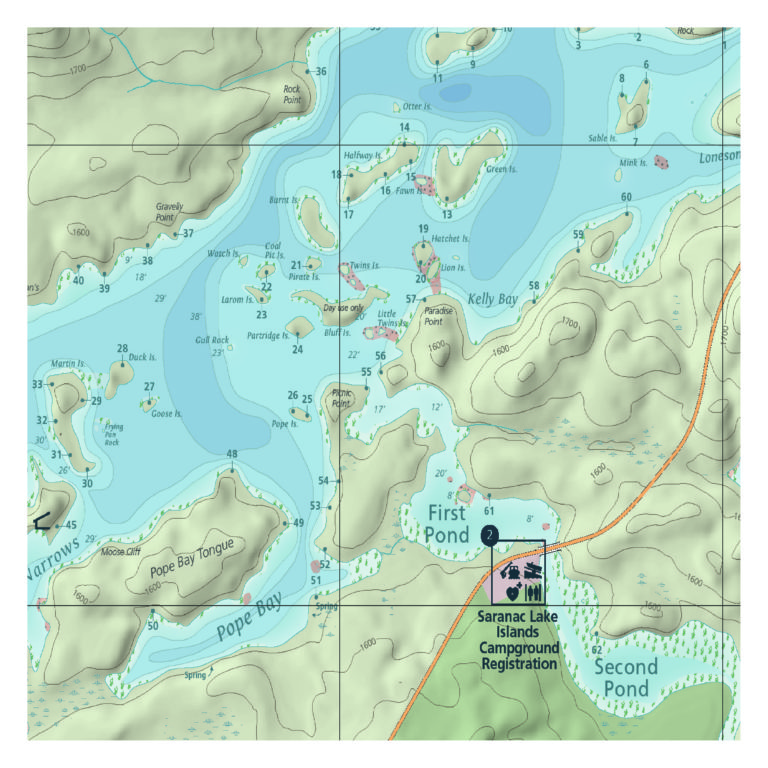
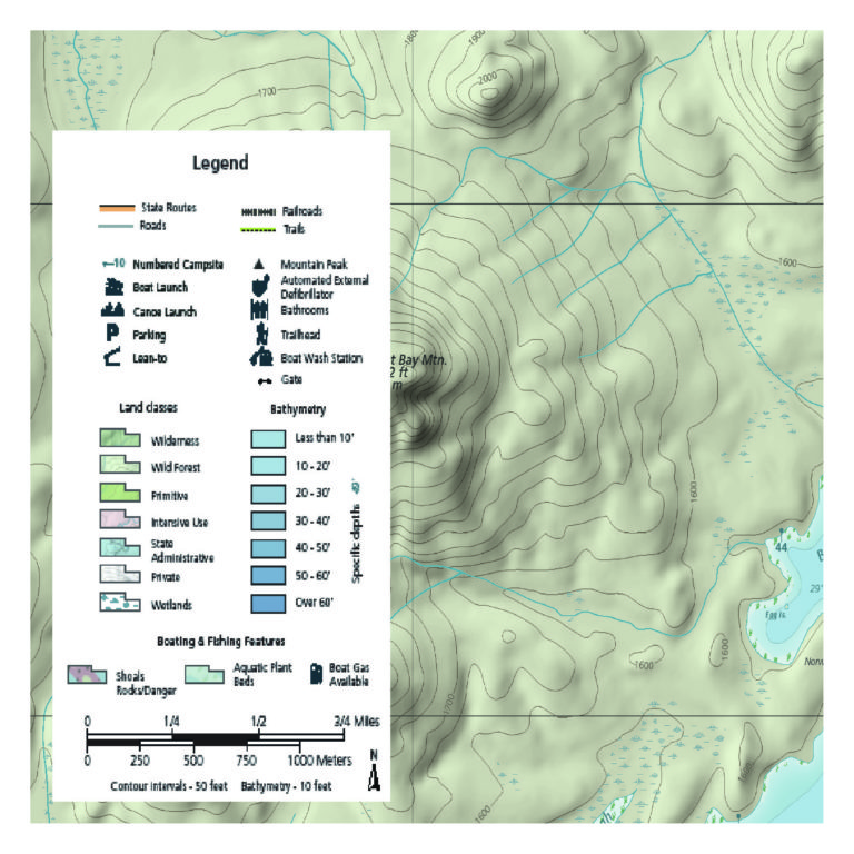
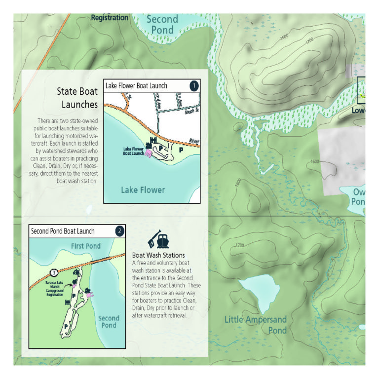
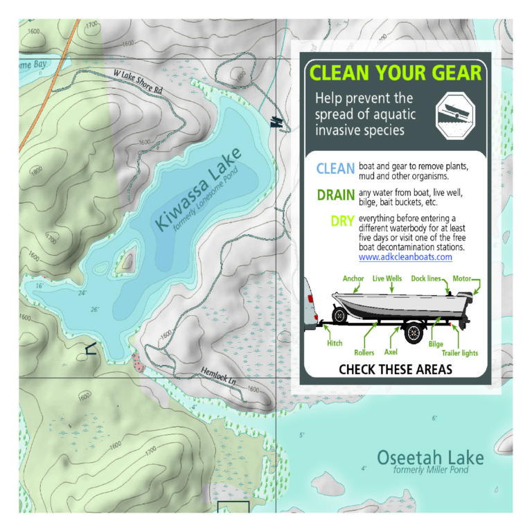
This is the only boating and fishing map for the Saranac Lake chain (Lower and Middle) that shows water depths and camp sites. The Saranac Lake Boating and Fishing Map shows locks and boat launches, shoals and aquatic plant beds for fishing, marinas and other features important for boaters.
All of our maps have an ecological focus. This map, with a partnership through The Nature Conservancy’s Adirondack Park Invasive Plant Program and their Keep Invasive Species Out Campaign, highlights invasive species prevention. Green Goat Maps gives 1% back to nonprofits through 1% for the Planet.
Made in the USA. Boating map measures 18×24” unfolded, 4×6” folded.
- Map Highlights
- 100% satisfaction return policy
- Description
- Additional information
- Boating and fishing information for the Saranac Lakes as well as Lake Flower, Oseetah, and Kiwassa
- Lake depths, rocks, vegetation beds, and navigation buoys
- Upper and lower locks, DEC boat launches, marinas, campsites, and more
- Printed on durable, high-quality waterproof material
We know you’ve got a lot going on, whether you’re planning a trip or gathering equipment for your Saturday family adventure. Don’t worry – we’ve got you covered. If this map isn’t perfect for your adventure, just let us know and we’ll refund your payment or send you a different map. We want you to be successful out there! Take a moment to view our shipping and returns policy.
Description
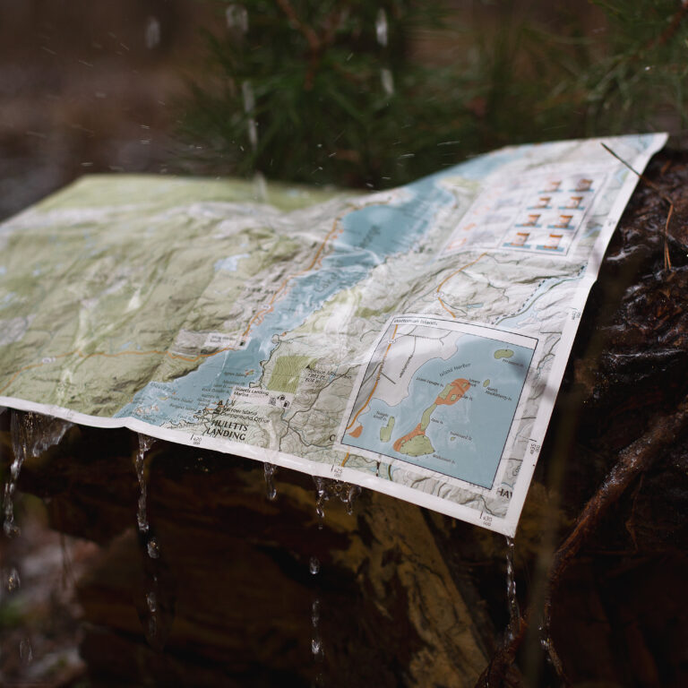
Printed on waterproof HopSyn material. Durable and tear-resistant. Made in the USA:
Cartography done in New York, printing done in Colorado. Map measures 18×24” unfolded, 4×6” folded.
Green Goat mappers are researchers at heart! Check out our partner company Adirondack Research to see all of the other environmental research and GIS mapping projects we are working on.
Additional information
| Weight | 4 oz |
|---|